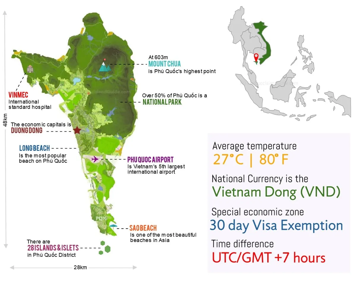
Phu Quoc is 48 km from north to south and 28 km across at its widest. More than half the island is national park, the main town is Duong Dong on the west coast, and there are many smaller islands and islets around it. For an interactive map, open the Google Map at the bottom of this page.
How far is everything from the airport?
The airport sits in the middle of the west coast, so nothing is very far — but the roads are slower than the map suggests. Typical drive times from Phu Quoc International Airport (OpenStreetMap routing, from the middle of each area):
| Area | By car | What is there |
|---|---|---|
| Long Beach | about 12 min | Most hotels, restaurants and beach bars |
| East coast (Ham Ninh) | about 19 min | Fishing villages, sunrise |
| Duong Dong | about 20 min | Town, night market, Dinh Cau |
| The south (Bai Khem, Sunset Town) | about 24 min | Best beaches, cable car |
| Ong Lang | about 25 min | Quiet resorts, sunsets |
| Cua Can | about 32 min | Jungle, river, Green Bay |
| Bai Dai (Vinpearl, Grand World) | about 40 min | Theme parks, safari, big resorts |
| Bai Thom (north-east) | about 41 min | Empty beaches, day trips |
For which area suits you, see where to stay on Phu Quoc.
Getting to the island
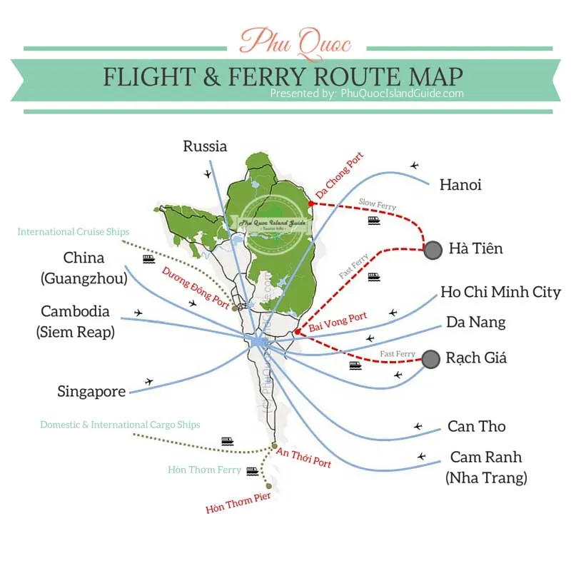
Ferries arrive at Bai Vong and Da Chong ports from Ha Tien and Rach Gia on the mainland — see ferries. Flights land at Phu Quoc International Airport south of Duong Dong.
Route lists on maps like this one date quickly. Check current schedules before you book.
Before you rely on a map here
There is no official tourist information centre. Plenty of restaurants, cafes and tour agencies describe themselves as one. They are selling something.
Treat the free printed maps with suspicion. The print maps and guidebooks handed out around the island are produced by tour operators, and much of the information in them is copied from Wikipedia and out of date.
Coverage is good, so use a digital map. Phu Quoc was an early adopter of 4G and the network covers most of the island. Local SIM cards are sold by VinaPhone, Viettel, Mobifone and FPT in Duong Dong — bring your passport, it is required to register a SIM.
Watch your phone. Phone snatching happens, particularly when you are standing still navigating or taking photos. See scams and safety.
Beaches
Best first. Each links to a full page with access notes and photos.
- Long Beach — Duong Dong. The island’s most popular beach.
- Bai Dai — Ganh Dau. Long stretch of sand backed by luxury resorts.
- Khem Beach — An Thoi. White sand and the island’s top resorts.
- Sao Beach — An Thoi. Famous white sand; read our notes on rubbish and entry fees first.
- Vung Bau — A quiet beach on a calm bay.
- Ong Lang — A series of rocky coves north of Duong Dong.
- Dam Beach — An Thoi. Off the beaten track, across from a large pagoda.
- Cay Sao — Ham Ninh. White sand and shallow blue water.
- Rach Tram — A remote fishing village on the north coast; the beach is no longer easy to reach.
- Rach Vem — Small beach, strongly affected by tides. Starfish Beach is at its eastern end.
- Cua Can — More estuary than beach, home to coastal wildlife.
- Bai Thom — Rugged, better for shore snorkelling than lounging.
- Dinh Cau — Duong Dong’s local beach, busiest at sunset.
- Ganh Dau — A small crescent bay popular with locals.
Offshore: Hon Mong Tay (Fingernail Island), Hon Gam Ghi, Hon Vong and the rest of the An Thoi archipelago.
Eco-tourism sites
- Ganh Dau Trail — The most popular nature trail on the island.
- Tranh Waterfall — The best waterfall site, and the one with facilities.
- Da Ban Stream — Flat granite slabs, pools and small falls.
- Phu Quoc National Park — Protected forest across the north of the island.
- Cua Can River — A shallow, scenic river you can kayak.
- Hon Mot — Small island joined to Phu Quoc by a man-made causeway.
- Mangrove forest — Coastal habitat that shields the island from flooding.
Duong Dong Lake and Dam, the largest freshwater lake in the archipelago, and the Rach Tram river system through the national park are both worth a detour but have no page of their own yet.
Landmarks and things to see
- Ho Quoc Pagoda — East coast, Duong To. The largest temple complex on the island.
- Dinh Cau Rock Temple — Duong Dong. The most visited sight on Phu Quoc.
- Cao Dai Temple — Duong Dong. Phu Quoc is the birthplace of Cao Daism.
- Nguyen Trung Truc Temple — Ganh Dau. Dedicated to the island’s local hero.
- Night Market — Duong Dong. Seafood, bars and shopping.
- Local markets — The working wet and dry markets.
- Fish sauce factory — Duong Dong. See how the island’s most famous export is made.
- Pepper farms — Farms you can visit, with products to taste.
- Wooden bridges — Cua Can. Rustic and disappearing.
- Ham Ninh pier — Ham Ninh. The old pier, partly demolished in 2020; stilt seafood restaurants around it.
- Coconut Tree Prison — An Thoi. A national heritage site.
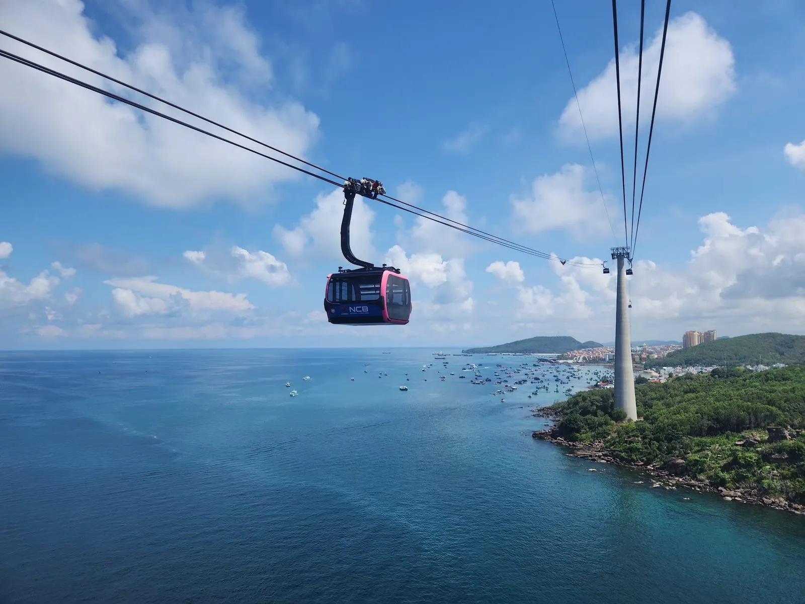
- Cable car — An Thoi to Hon Thom, the longest over-sea cable car.
- Theme parks and safari — VinWonders, the safari and Grand World at Bai Dai; Sunset Town and the Kiss Bridge in An Thoi.
- An Thoi — The port town and gateway to the marine park.
Drive times: OpenStreetMap routing (OSRM), October 2026. Expect longer in Duong Dong traffic.
Map
Loads Google Maps when you tap. Or open in Google Maps.