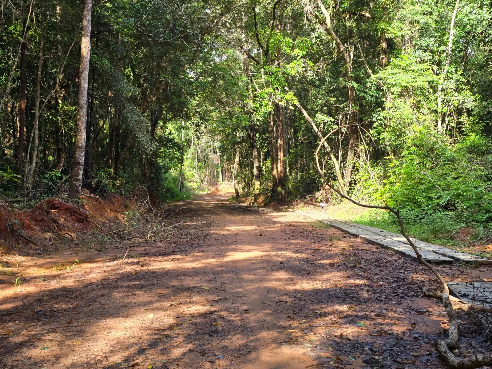
The Ganh Dau trail is an unpaved track of about 5 km that cuts through the forest of Phu Quoc National Park across the island’s northern tip, between the Ganh Dau area in the west and the road towards Rach Vem in the east. It is not a marked hiking path but an old dirt road under the trees, and you can walk it, cycle it on a mountain bike or ride it on a motorbike.
What it is like
- The track: red earth and gravel, mostly gentle, with dips, ruts and slippery patches. A visitor who rode it by motorbike in August 2026 called it “raw” and “heart-pumping” — not dangerous if you take care, but it needs your full attention.
- After rain: reviewers in 2026 found it very muddy and, after heavy rain, practically impassable. Go in the dry season, November to April, or after a few dry days.
- The forest: tall trees, ferns and orchids. Look out for Vu Rock, a huge boulder standing alone in the forest, and the giant old trees; in 2025 the national park had six of its trees recognised as Vietnam Heritage Trees, though one visitor looking for them along the track found no signs. Early morning is best for birds and monkeys — see bird watching.
- The rules: this is national park land, and a park notice board along the track lists what is forbidden. Stay on the track, do not light fires and take your rubbish with you; there is already too much litter along the way.
Getting there
The western end of the track is near Ganh Dau, about 30–45 minutes from Duong Dong by road; a trailhead is marked on Google Maps as “Ganh Dau Tail Trailhead”. Bring water, fill up with petrol in Ganh Dau and wear shoes you do not mind getting muddy. Tell your hotel where you are going, and do not set off late: one visitor in June 2026 arrived after dark and had to turn back.
Combine it with
- Rach Vem at the eastern end, for a seafood lunch on the stilt restaurants and Starfish Beach.
- Ganh Dau village and cape, with views across to the Cambodian coast; see Ganh Dau. Agree the price and length of any boat trip before you set off.
- The “Public Cove” near the cape (4.7 on Google Maps from 22 reviews), a rocky cove that reviewers single out as one of the few places in the north where anyone can snorkel from the shore. In late 2025 the bridge to it was broken and the last stretch had to be walked.
- The Nguyen Trung Truc temple at Ganh Dau.
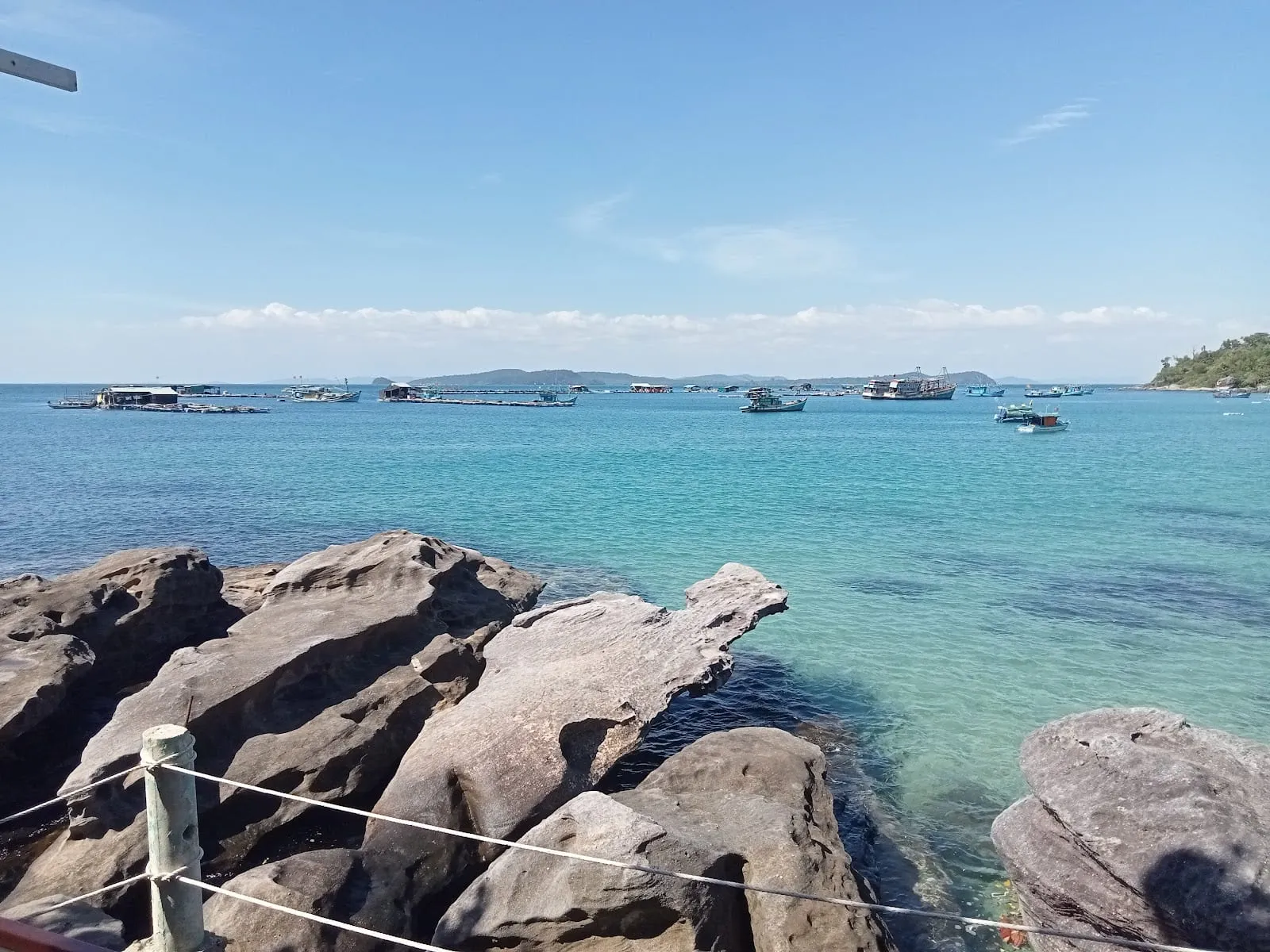 The cove near Ganh Dau cape. Photo: Pier Carlu Marcellesi, via Google Maps
For more walks, see hiking on Phu Quoc and the Tien Son Dinh climb.
Visitor comments and ratings: Google Maps, 2025–2026.
Map
Loads Google Maps when you tap. Or open in Google Maps.